Ōtaki residents see the pending expressway in largely abstract form as construction continues, so Ōtaki Today is often asked about how the two main interchanges will work.
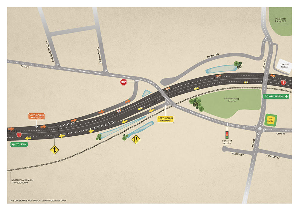
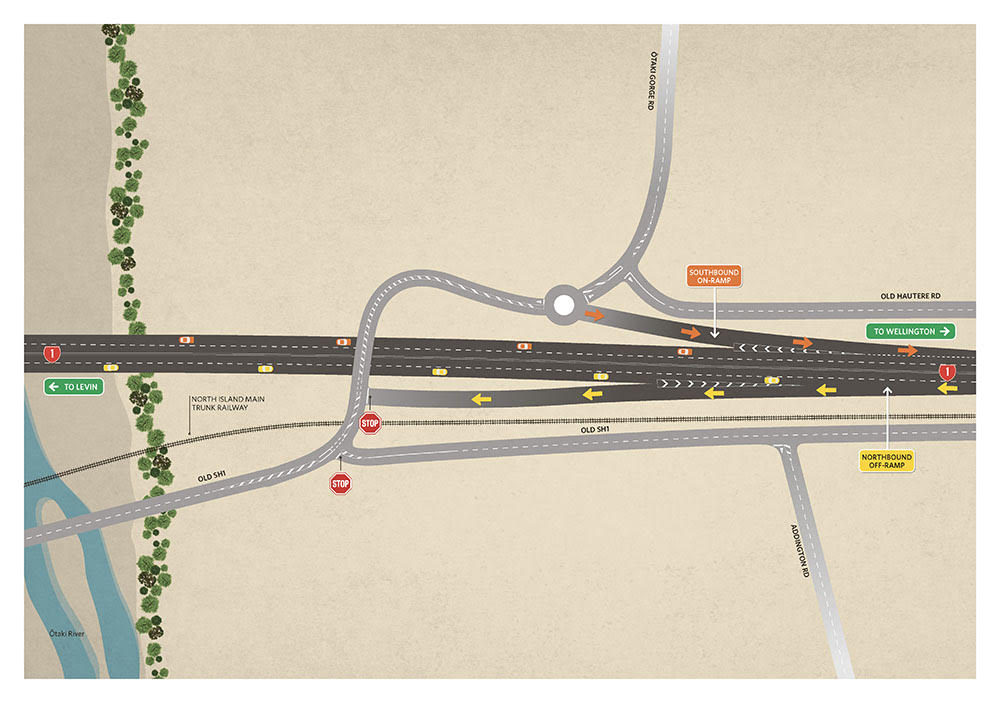
The diagrams show how locals and visitors can get on and off the expressway.
The top diagram is the interchange just north of the BP roundabout. It shows that drivers from the north can exit the expressway on to what will be a local road – currently the highway – to go north towards Te Manuao Road or south into the Railway area. County Road is closed at the top end. Traffic can get onto the expressway to go north by turning left before the new bridges.
The other interchange is just south of the Ōtaki River, showing how local traffic can get on the expressway to go south via a new roundabout at Ōtaki Gorge Road. Traffic can also exit the expressway going north, which leads to the old state highway.


